Norðurþing
Norðurþing is a municipality located in northern Iceland. Norðurþing was formed in 2006 when the municipalities of Húsavík, Öxarfjörður, Raufarhöfn, and Kelduneshreppur were merged after special elections in January 2006 and the region was officially declared a new municipality on 10 June 2006.
The biggest town in the municipality is Húsavík, with a population of 2,307 inhabitants. Other settlements include Kópasker (population 122), Raufarhöfn (population 186), and Skinnastaður.
Húsavík is known as the whale watching capital of Europe and is centrally located for visitors coming to the area who intend to visit Mývatn, Dettifoss, Goðafoss, or the Vatnajökull National Park. Kópasker is home to the Earth Quake Center and a local folk museum.
In Raufarhöfn, an attraction called the Arctic Henge is currently being built and is already attracting visitors.
Norðurþing is twinned with:
* Aalborg, Denmark
* ?? Eastport, United States
* ?? Fredrikstad, Norway
* ?? Fuglafjørður, Faroe Islands
* ?? Karlskoga, Sweden
Map - Norðurþing
Map
Country - Iceland
 |
 |
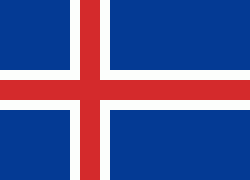
| Flag of Iceland | |
According to the ancient manuscript Landnámabók, the settlement of Iceland began in 874 AD when the Norwegian chieftain Ingólfr Arnarson became the first permanent settler on the island. In the following centuries, Norwegians, and to a lesser extent other Scandinavians, immigrated to Iceland, bringing with them thralls (i.e., slaves or serfs) of Gaelic origin.
Currency / Language
| ISO | Currency | Symbol | Significant figures |
|---|---|---|---|
| ISK | Icelandic króna | kr | 0 |
| ISO | Language |
|---|---|
| DA | Danish language |
| EN | English language |
| DE | German language |
| IS | Icelandic language |
| NO | Norwegian language |
| SV | Swedish language |


